Sungbo's Eredo
How did a pre-colonial forest kingdom in what is now southwest Nigeria organize the labour to dig a single continuous bank-and-ditch running some 160 kilometres — moving, by one estimate, more earth than the Great Pyramid of Giza — and why has one of Africa's largest ancient monuments been so little studied that even its date and purpose remain unsettled?
Why this rating?
- Construction difficulty
- 3/5
- Method uncertainty
- 3/5
- Capability gap
- 2/5
- Open questions
- 5/5
The engineering here is earthmoving, not precision masonry, so the physical task — digging a ditch and piling the spoil into a bank — is well within the known capability of the societies that built it; that keeps the capability gap low and construction difficulty only moderate. What makes the Eredo extraordinary is scale and coordination: a single continuous work roughly 160 km long, with a bank-and-ditch drop reaching about 20 m, representing an estimated ~3.5 million cubic metres of moved earth and, by Darling's reckoning, more soil than the Great Pyramid of Giza. Directing that much sustained labour implies a large, organized forest polity, but exactly who mobilized it, how, and to what end is genuinely unresolved. Open questions run high because the monument is astonishingly understudied: its very date is contested (Darling's 10th–11th century estimate versus a 14th–15th century range from recent stratigraphic excavation), its purpose is inferred rather than demonstrated, and comprehensive mapping only arrived with a LiDAR survey whose analysis is expected to take a decade.
Overview
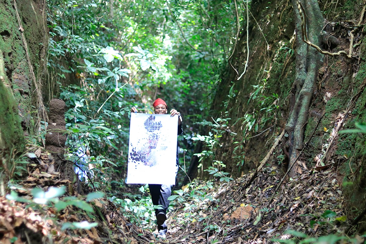
In the rainforest southwest of Ijebu-Ode, in Nigeria’s Ogun State, the ground gives way without warning into a deep, green-walled trench that runs — with interruptions — for something like 160 kilometres in a rough loop around the old Yoruba kingdom of Ijebu. This is Sungbo’s Eredo: an enormous earthwork of ditch and bank, one of the largest single pre-colonial monuments anywhere in Africa, and quite possibly the largest earthen enclosure in the world. “Eredo” is simply the local word for the ditch or embankment; “Sungbo” attaches the whole thing to Bilikisu Sungbo, a wealthy, childless noblewoman of Ijebu legend whose reputed grave, in a sacred grove at Oke-Eri, still draws pilgrims. For centuries the Eredo was known mainly through oral tradition and the everyday experience of farmers whose land it crossed. Only in the late 1990s did the British archaeologist Patrick Darling produce the first near-complete map of it, and his headline conclusion — that building it had required moving more earth than the Great Pyramid of Giza — turned a local landmark into a candidate for one of the great overlooked wonders of the ancient world. What is most striking about the Eredo today is not just its size but how little formal study it has received: a monument on the scale of a national border, tied to a documented kingdom, sitting on Nigeria’s UNESCO World Heritage tentative list, and yet still argued over on the most basic points of when it was built and why.
The Structure
The Eredo is a bank-and-ditch system: a trench dug into the earth with the excavated spoil heaped up as a rampart along its inner edge. Along much of its course the ditch walls are unusually smooth and close to vertical, and where bank and ditch survive at full height the drop from the top of the embankment to the floor of the trench can reach around 20 metres — roughly the height of a six-storey building. The whole system runs for a total of more than 160 kilometres (about 100 miles); Darling’s survey put it near that figure, later radiocarbon-and-mapping work has quoted lengths around 165 km, and a 2024 LiDAR survey suggests the true extent may be closer to 170 km, larger than either Darling or later researchers had predicted. Rather than a straight defensive line, the Eredo forms a rough enclosure roughly 40 kilometres from north to south and about 35 kilometres east to west, ringing a territory larger than Greater London with the town of Ijebu-Ode near its heart. The earthwork is not a wall in the masonry sense — there is no stone — but a sculpted landscape of ditch and rampart, carved out of the region’s soft, deeply weathered forest soils and now, along most of its length, swallowed by dense vegetation that both hides it and, in places, holds its steep sides together. It is this combination of features — the length of a modern motorway, the depth of a canyon in the tropics, and walls smooth enough to look deliberately finished — that has led observers to call it, without much exaggeration, the largest single ancient monument in Africa.
How Was It Built?
Physically, the Eredo was made the way earthworks everywhere are made: by digging. Workers cut down through the weathered forest soil and laterite, lifted the spoil, and piled it as a bank on the inner side, shaping and smoothing the ditch walls as they went. There is no evidence of exotic technique or tooling — iron and wooden hand tools, baskets, and human muscle are entirely sufficient to explain what survives, which is exactly why the wonder of the Eredo lies not in how each metre was dug but in the sheer coordinated volume of it. Estimates put the total earth moved at roughly 3.5 million cubic metres, and it was Darling who framed the comparison that has followed the site ever since: on his reckoning, building the Eredo shifted more soil than was used to raise the Great Pyramid of Giza. That comparison is an estimate, not a survey-grade measurement, and it should be read as Darling’s characterization of scale rather than a precise volumetric fact — but even taken cautiously it makes the essential point. A continuous work on this scale is really a problem of organization: mobilizing, feeding, and directing a very large workforce, probably drawn from many communities, over what may have been years, and coordinating the line so that separately dug sections joined into one coherent enclosure. The Eredo therefore reads less as a triumph of engineering nerve than as evidence of a society able to marshal collective labour at a level historians once did not associate with the West African forest belt at all. Precisely how that labour was recruited and led — by a central authority, by obligation, by cooperating towns — is not recorded and remains one of the monument’s real unknowns.
The Mainstream View
Archaeologists working on the Eredo agree on its broad character: it is a genuine, human-made bank-and-ditch enclosure associated with the Ijebu kingdom, one of the Yoruba forest states, and it represents an exceptional feat of pre-colonial labour organization. Darling’s fieldwork from the mid-1990s — combining aerial photographs, ground survey by canoe and motorcycle, and GPS — established the first coherent outline of the system and argued that it could push back the understood beginnings of state formation in the African rainforest by several centuries. In that light the Eredo is usually read as the boundary and defensive perimeter of a consolidating polity: a marker of territory and authority as much as a barrier, its scale advertising the power of whoever commanded its construction. The connection to Bilikisu Sungbo is treated as living oral tradition rather than documented history — she is remembered as a rich, childless widow who financed a monumental work in place of leaving heirs, and her grove at Oke-Eri remains an active shrine. The further, popular claim that Bilikisu Sungbo was the biblical Queen of Sheba is firmly a legend, not an archaeological finding; there is no material evidence linking the site to Sheba, and Darling himself noted that the dating is the strongest argument against the idea. On the essentials, then, the mainstream position is confident: this is an Ijebu-built earthwork of remarkable scale, defensive and territorial in function, embedded in Yoruba memory of a wealthy patron.
The Open Case
What is remarkable is how much remains genuinely unsettled for a monument this large. The dating is openly contested. Darling’s radiocarbon work pointed to construction around the 10th to 11th centuries CE — the source of the widely quoted “c. 800–1000 CE” figure — while later excavation by the Ife-Sungbo Archaeological Project, led by Gérard Chouin and Adisa Ogunfolakan, obtained a full stratigraphic profile of a ditch-and-bank section and dated it to the late 14th or early 15th century, several hundred years younger. Older carbon dates reaching back toward 2000 BCE reflect earlier human activity in the landscape, not the digging of the ditch itself. Which reading is correct matters a great deal, because it changes what political world the Eredo belongs to and what it was for. Purpose, too, is inferred rather than demonstrated: defence, boundary-marking, a display of a ruler’s power, or some combination — the earthwork does not, by itself, prove which. And the deepest question is one the monument shares with almost nothing else of its size: who organized the labour, under what authority, and how it was sustained. The reason these questions stay open is simple and striking — the Eredo has barely been studied. For a structure often called Africa’s largest single ancient monument, formal archaeological excavation has been minimal and intermittent, and it has meanwhile been eaten at by erosion, farming, road-cutting, sand mining, and the steady encroachment of settlement, with long stretches lost under forest. Only in 2024 did a LiDAR survey led by the Ife-Sungbo team finally map it comprehensively, covering some 1,000 square kilometres — and the analysis of that data is expected to take a decade. Sungbo’s Eredo is thus a rare thing: a monument on the scale of a wonder that the world has, for the most part, simply never gotten around to examining.
Sources
- Wikipedia — Sungbo's Eredo
- HeritageDaily — Sungbo's Eredo: The "Queen of Sheba's Embankment"
- P. J. Darling — "Sungbo's Eredo, Southern Nigeria", Nyame Akuma No. 49 (June 1998)
- William & Mary News — LiDAR project maps world's largest earthen enclosure (Dec 2024)
- IFRA Nigeria — Ife-Sungbo Archaeological Project (Chouin & Ogunfolakan)
- SuRGe / William & Mary — Earthworks of Ijebu-Ode
- Ife-Sungbo Archaeological Project — 2015 Final Report on Rapid Assessment of Earthwork Sites at Eredo and Ilara-Epe (Chouin & Ogunfolakan)
Connected findings
- Nobody Gave the Order — A monument is supposed to need a monarch — surplus to feed the workers, a hierarchy to marshal them, a ruler who can command. Two peoples an ocean and an age apart moved earth by the millions of cubic yards, basket by basket, and left no palace, no throne, no trace of the coercion the textbooks demanded.