Si Thep
How did an inland Dvaravati city engineer earthen ramparts, moats, and reservoirs to sustain a major population for roughly a thousand years, and what ultimately drove its abandonment?
Why this rating?
- Construction difficulty
- 3/5
- Method uncertainty
- 3/5
- Capability gap
- 2/5
- Open questions
- 4/5
The earthen ramparts, moats, and laterite-and-stucco monuments draw on well-attested regional Dvaravati and Khmer building traditions rather than exceeding them, but the specific hydraulic engineering behind the city's ramparts and reservoirs is thinly documented, and the causes of its eventual abandonment remain genuinely debated among several competing theories.
Overview
Si Thep (also spelled Sri Thep) is the ruin of a large, moated inland city in what is now Phetchabun Province, north-central Thailand, sitting at the point where the Dvaravati culture of the Chao Phraya lowlands met the trade and religious networks of the Khmer Angkorian world. Rather than a single walled compound, Si Thep was built as a linked pair of moated settlements — an older, roughly circular Inner Town and a larger Outer Town extending beside it — enclosed by earthen ramparts and threaded with reservoirs and ponds engineered to hold water for a substantial population in a comparatively dry inland setting. Occupied for close to a thousand years, from around the 4th century CE into the 13th century, the city passed through several religious and political phases in turn: an early Hindu Vaishnavite period, a flourishing Buddhist Dvaravati phase, and a final Khmer-influenced Hindu Shaivite phase, all layered into the same urban footprint. Rediscovered and named during an official 1904 survey by Prince Damrong Rajanubhab, protected as an ancient monument in 1935, and opened as a historical park in 1984, Si Thep was inscribed as a UNESCO World Heritage Site in September 2023 — Thailand’s first purely archaeological cultural listing since Ban Chiang in 1992 — recognized for its unusually intact urban planning and for its role as a place where Theravada Buddhism, Mahayana Buddhism, and Hinduism visibly coexisted.
The Structure
Archaeologists generally place the earliest settlement at Si Thep in the 3rd or 4th century CE, with the town developing over the following centuries into one of the two most important supra-regional centers of the Dvaravati culture, alongside Nakhon Pathom far to the south. The commonly proposed sequence runs from an early settlement phase (4th-5th century), through a Hindu Vaishnavite era (6th-8th century), into a Buddhist flourishing usually described as the city’s most prosperous period (8th-10th century), and finally an Angkorian-influenced Shaivite phase (11th-13th century) during which Khmer-style tower shrines were added to the skyline. The city is recorded as having sent a tributary mission to the Chinese imperial court around 656-661 CE under the name “Qian Zhi Fu,” evidence of its reach as a regional power, and by some accounts it was later absorbed into the Khmer sphere under Angkor in the 10th century. Abandonment followed sometime after the 13th century, roughly coinciding with the rise of the Thai kingdom of Sukhothai.
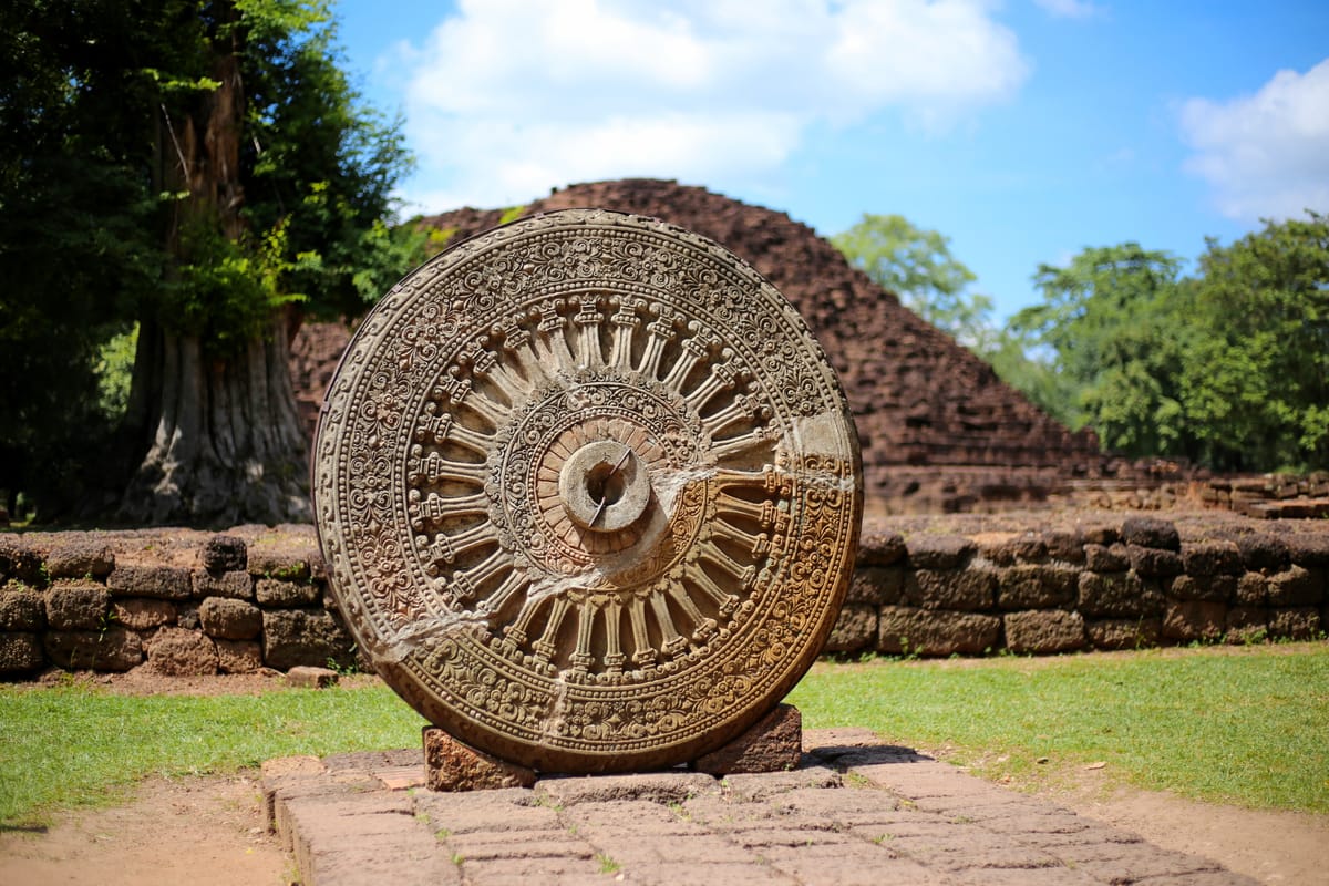
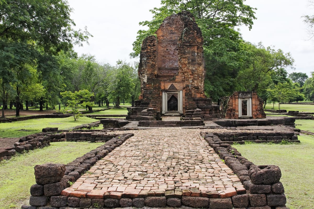
The inscribed property, formally named “The Ancient Town of Si Thep and its Associated Dvaravati Monuments,” is a serial UNESCO listing of three components: the twin-moated town itself, the standalone monument of Khao Klang Nok outside the walls, and the Khao Thamorrat cave monastery. The moated town core covers roughly 4.7 square kilometers, while the full inscribed property together with its surrounding monuments totals about 866 hectares, set within a much larger buffer zone of nearly 3,825 hectares. More than 112 individual monastery sites have been identified within the property, alongside major monuments including Khao Klang Nai, Khao Klang Nok, the Khmer-style towers Prang Si Thep, Prang Song Phi Nong, and Prang Ruesi, and the Khao Thamorrat cave shrine. Surviving artifacts include Pallava-script Sanskrit and Pali inscriptions (one dated to the 6th century), carved stone Dharmachakra “Wheels of the Law,” and Vishnu sculptures, and art historians credit the city with its own recognizable “Si Thep school” of round-relief sculpture, notable for standing figures in the tribhanga (thrice-bent) posture carved without a supporting back-arch — a stylistic contribution that scholars trace forward into later Southeast Asian sculptural traditions.
How Was It Built?
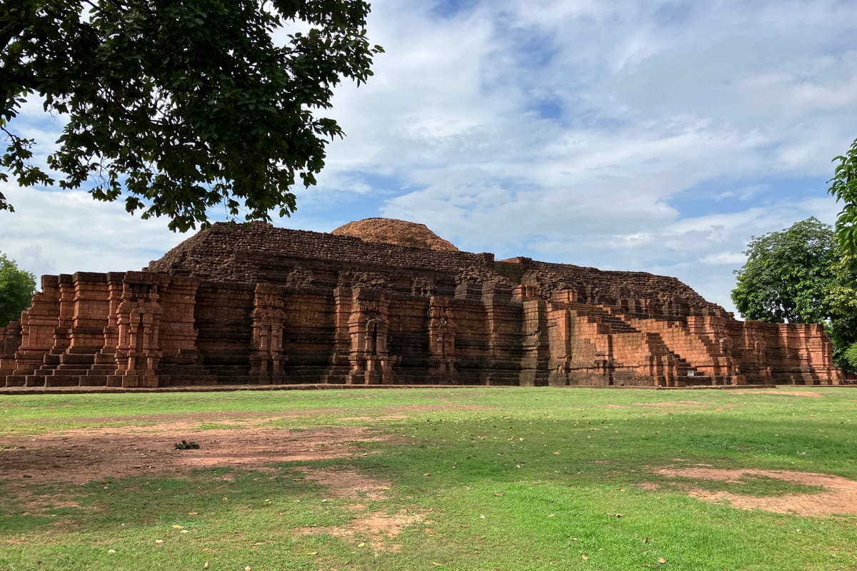
The city’s major religious monuments were built primarily of laterite, a soft, iron-rich soil that is quarried in blocks while still damp and hardens on exposure to air, then commonly finished with molded stucco ornamentation. Khao Klang Nai, dated to roughly the 6th-7th century, is a rectangular laterite stupa base decorated with stucco reliefs of dwarf figures and associated with carved Dharmachakra wheels. Khao Klang Nok, dated slightly later to the 7th-8th century, is the largest surviving Dvaravati-period monument in Thailand: a vast, square-plan, stepped laterite stupa that once stood roughly 20 meters tall, now partially collapsed, and locally nicknamed “Thailand’s pyramid.” The later Khmer-style towers, Prang Si Thep and Prang Song Phi Nong, were likewise built of laterite in the 11th-12th century, originally raised as Hindu Shaivite shrines before being adapted for Buddhist use as the city’s religious character shifted again.
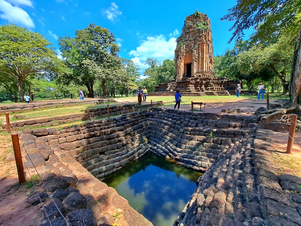
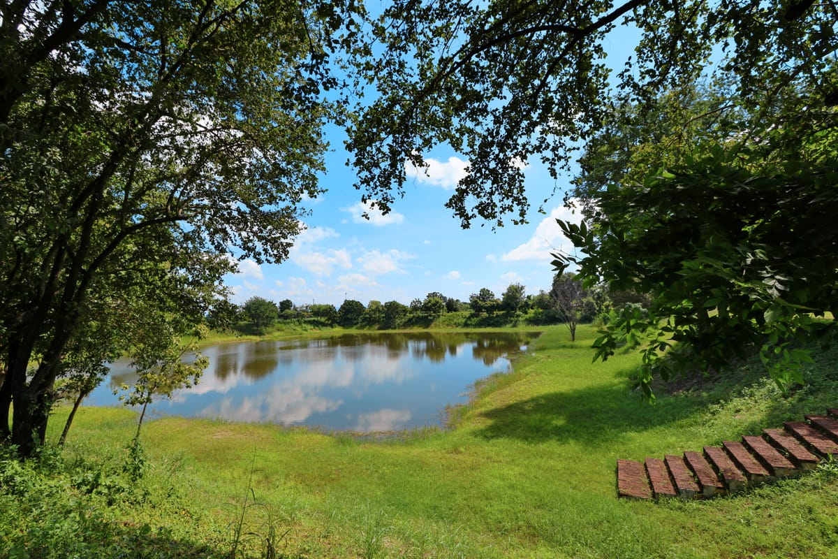
Around and beneath the monuments, the city itself was defined by large-scale earthworks: encircling earthen ramparts and moats around both the Inner and Outer Towns, and a network of ponds and reservoirs — including a large named reservoir, Sa Kaeo, north of the city — that stored and managed water in a relatively arid inland setting, unusual among Dvaravati sites more typically found nearer the wetter Chao Phraya floodplain. The general layout of these earthworks is well mapped, but the specific hydraulic engineering behind them — how the moats were fed, how water levels were maintained through dry seasons, and how the reservoir network supplied a large resident population over centuries — is not well documented in the accessible archaeological literature, and appears to be a genuine gap in current published knowledge rather than a settled, well-understood system.
The Mainstream View
Archaeologists and art historians treat Si Thep as the product of an established, well-organized regional civilization rather than an isolated anomaly. Its twin-town moated layout, laterite-and-stucco monument construction, and blending of Hindu and Buddhist iconography all have parallels elsewhere in the Dvaravati cultural sphere and in the neighboring Khmer world, indicating a shared regional building and religious tradition rather than a one-off local invention. The city’s tributary mission to China in the mid-7th century is read as independent evidence of a functioning, diplomatically engaged state capable of organizing long-distance travel and formal exchange, consistent with a settlement large and prosperous enough to undertake sustained monumental construction over many generations. On this view, the shifting religious character of the site — from Hindu Vaishnavite, to Buddhist, to Khmer-influenced Shaivite, with continuing Buddhist practice throughout — reflects Si Thep’s position astride active trade and pilgrimage routes linking the Dvaravati lowlands to the Angkorian world, rather than any single ruling ideology or building method, and its eventual eclipse is broadly attributed to the rise of new political centers, chiefly Sukhothai and later Ayutthaya, that redirected trade and power away from the old Dvaravati heartland.
The Open Case
What remains genuinely open at Si Thep is less the question of who could have built it — the laterite quarrying, stucco work, and earthwork techniques are all attested regional skills, and the city’s tributary contact with China confirms it as a real, organized polity — than the finer details of how it was engineered and why it ultimately fell silent. The specific hydraulics of a moat-and-reservoir system large enough to serve a walled city of this scale, in a comparatively dry inland location, for the better part of a thousand years, have not been reconstructed in detail from the published record, leaving the day-to-day water-management engineering behind Si Thep’s survival as a real unresolved question rather than a fully documented achievement. The city’s abandonment is similarly contested: proposed explanations include the political eclipse of the region by the rising Thai kingdoms, administrative shifts under Khmer rule, environmental or climatic stress, and disease, but no single cause has been established, and scholars openly disagree on how much weight each deserves. Adding a further layer of mystery, a 2023 LiDAR survey around Khao Klang Nok revealed a wider distribution of previously unrecorded structures and activity areas than expected, leading some researchers to suggest the site may have served purposes beyond purely religious ones — possibly functioning, in part, as a center of learning — a reminder that the map of Si Thep is still actively being redrawn. None of this points beyond the historically attested Dvaravati and Khmer societies that plainly built and used the city — but the precise engineering of its water system, and the true story of its long silence, remain genuinely open questions for archaeology to resolve.
Sources
- UNESCO World Heritage Centre — The Ancient Town of Si Thep and its Associated Dvaravati Monuments
- Wikipedia — Si Thep Historical Park
- TIME — Si Thep, Thailand's Newest UNESCO World Heritage Site
- Thailand Ministry of Foreign Affairs — Si Thep
- Southeast Asian Archaeology — LiDAR Reveals New Structures Around the Si Thep Historical Park
On screen
- The City You Wake Up In — Thailand's own Fine Arts Department built a free action-adventure game inside Si Thep — and used the UNESCO listing as its level select.
Gallery