Angkor Wat
How did a 12th-century kingdom quarry, move, and raise several million sandstone blocks — some hauled nearly 40 kilometers from a mountain quarry — into a temple-mountain so precisely built and aligned that its central tower still catches the sunrise at the equinox?
Why this rating?
- Construction difficulty
- 4/5
- Method uncertainty
- 2/5
- Capability gap
- 3/5
- Open questions
- 3/5
Angkor Wat's scale is well explained: the 2011-2012 Uchida-Shimoda quarry survey traced its sandstone to Phnom Kulen and mapped a canal transport route, and the temple's chronology and patronage are secure. What remains open is the fine mechanics of barge logistics, the mortarless precision jointing achieved without iron tools, and how the equinox solar alignment was surveyed across a decades-long build.
Overview
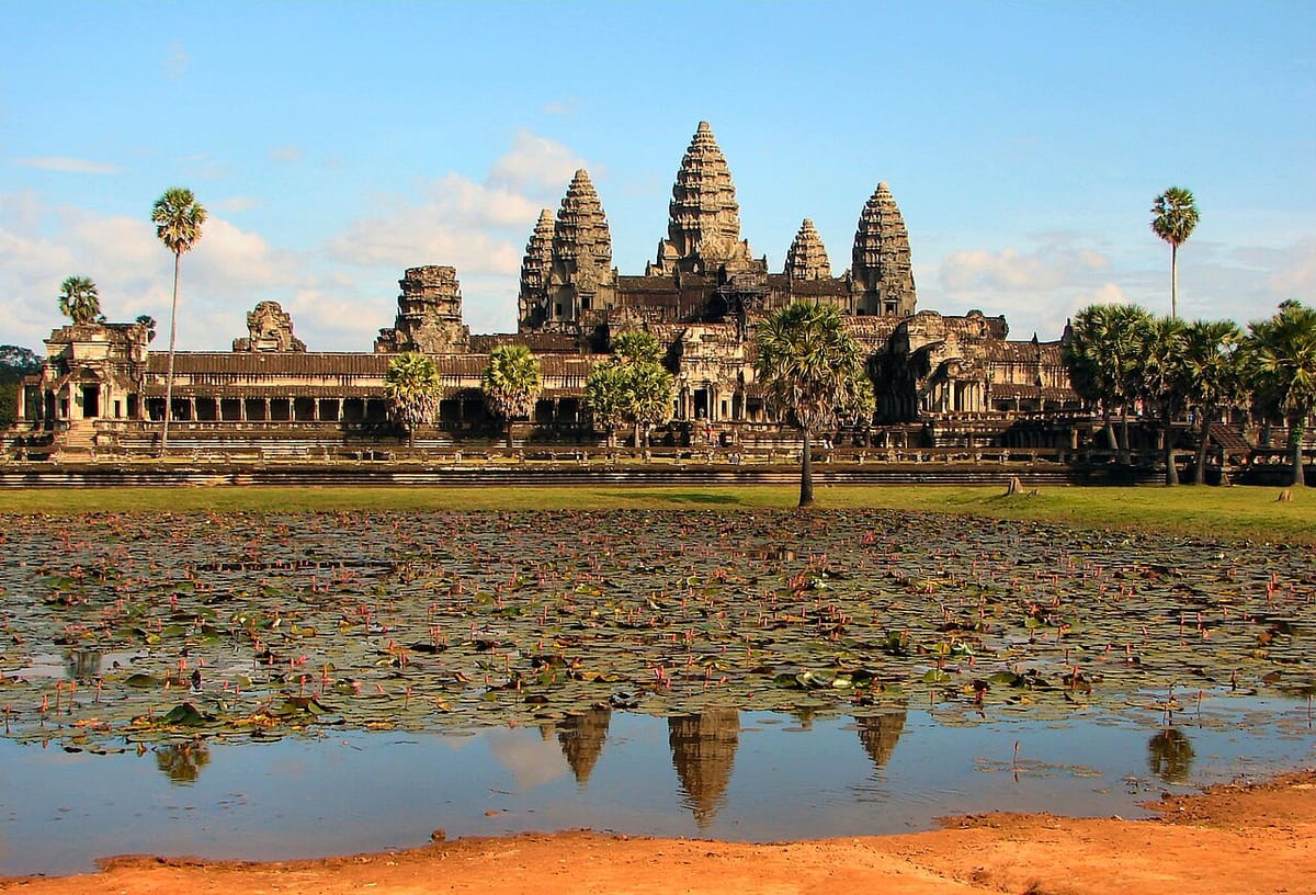
Angkor Wat, just north of modern Siem Reap in northwestern Cambodia, is the largest religious monument in the world by ground area: a single sandstone temple complex covering roughly 162 hectares (1.6 square kilometers) inside a moat more than 5 kilometers in perimeter. It was built by the Khmer Empire in the first half of the 12th century CE as the state temple of King Suryavarman II, who dedicated it to the Hindu god Vishnu. Its silhouette — five lotus-bud towers rising from tiered galleries, the tallest reaching about 65 meters — is the single most recognizable image of Cambodia and appears on the national flag. Unlike most Angkorian temples, which were abandoned to jungle after the empire’s decline, Angkor Wat was never fully deserted: from the late 13th century it was gradually adapted for Theravada Buddhist worship and has remained an active religious site for more than 800 years. Angkor Wat is also only the best-known monument within the much larger Angkor archaeological complex, a roughly 400-square-kilometer landscape of temples, roads, and water infrastructure that served, in turn, as the capital region of the Khmer Empire for centuries. The site was inscribed as part of the “Angkor” UNESCO World Heritage property in 1992.
The Structure
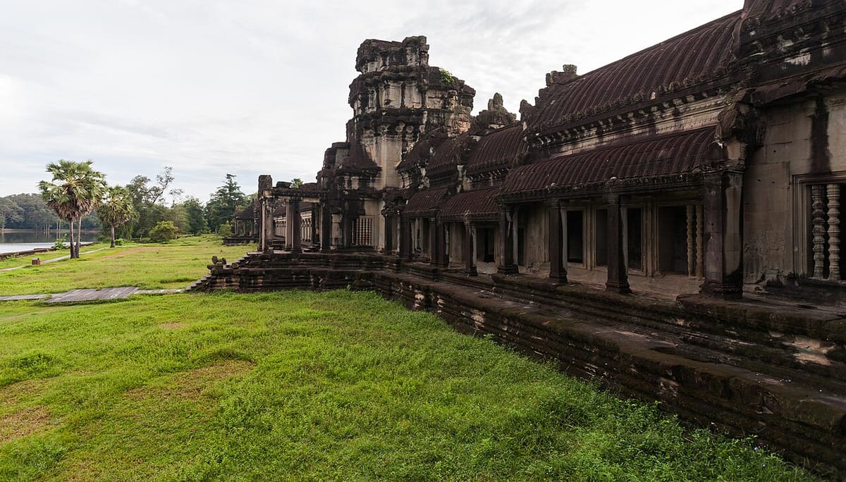
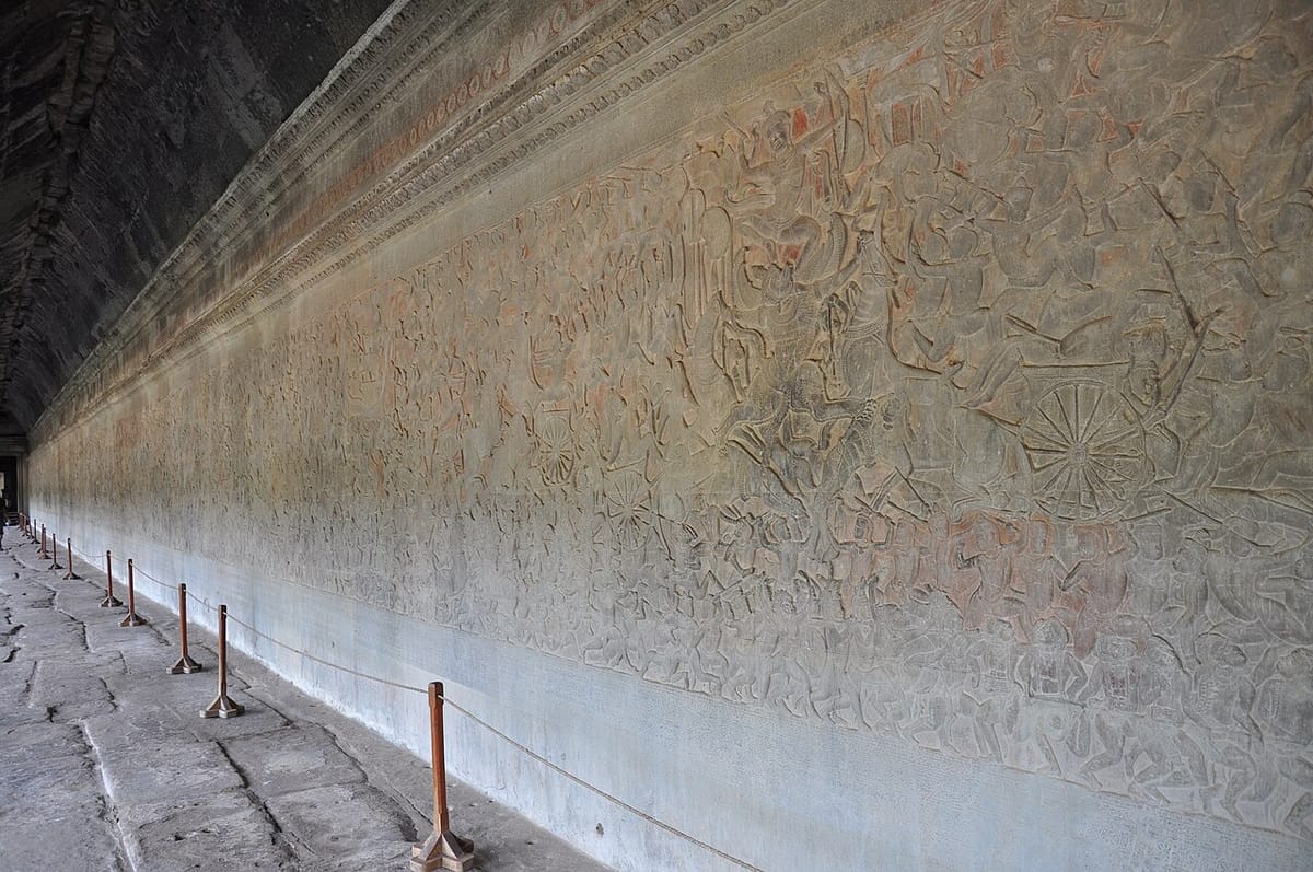
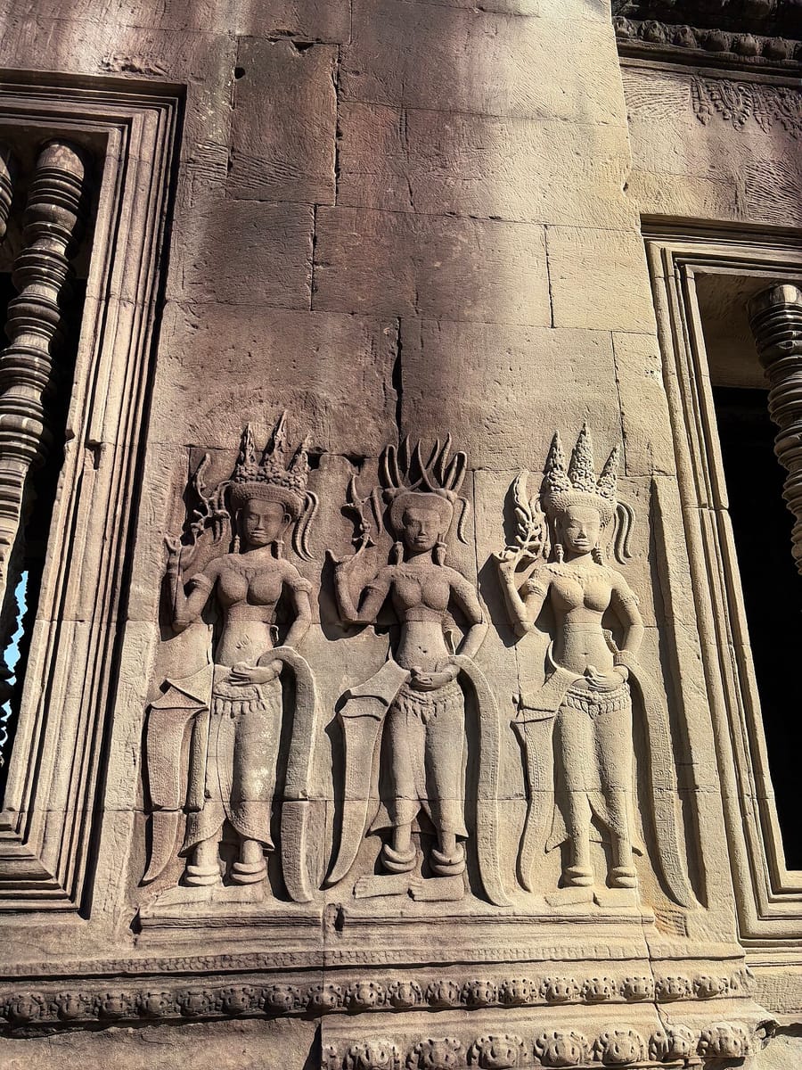
Angkor Wat was built during the reign of Suryavarman II (r. 1113 - c. 1150 CE), one of the Khmer Empire’s most powerful rulers, who came to the throne after defeating rival claimants and went on to expand Khmer territory and international contacts, including embassies to China. Construction is generally dated to roughly 1113-1150, meaning the temple may not have been fully finished — some of its bas-relief carving appears unfinished — at the time of the king’s death. It was conceived as a representation of Mount Meru, the mythical home of the Hindu gods: the central tower and its four surrounding towers form a quincunx standing in for Meru’s five peaks, the enclosing walls represent the mountains ringing the world, and the wide moat stands in for the cosmic ocean. The whole complex is oriented toward the west, unusual among Angkorian state temples (most of which face east), a choice scholars connect to Vishnu’s association with the setting sun and, by some interpretations, to a possible funerary function for the king. Three progressively elevated rectangular galleries lead up to the central tower sanctuary, and the outer walls are lined with bas-relief carvings — one continuous gallery alone runs nearly 800 meters and includes an almost 50-meter panel depicting the Hindu myth of the “Churning of the Sea of Milk.” Elsewhere across the temple, nearly 1,800 carved figures of devata (female divine attendants) decorate pillars, walls, and niches, each individually detailed down to jewelry, headdress, and hairstyle. Angkor Wat was not an isolated monument but the religious centerpiece of a much larger settlement and water-management system — the “hydraulic city” of Greater Angkor — that, at its height, supported a population estimated in the hundreds of thousands across a low-density urban sprawl of canals, roads, and reservoirs (baray) whose traces are still visible in LIDAR and satellite imagery today.
How Was It Built?
The temple’s structural core is built mainly of sandstone, with laterite (a porous iron-rich rock that hardens on exposure to air) used for the outer enclosure wall, foundations, and other hidden structural elements. Modern estimates put the volume of sandstone used at several million blocks, some weighing up to about 1.5 tonnes each, along with an estimated 3 million cubic meters of sand and clay fill beneath the temple platform, revealed by recent LIDAR survey work. Crucially, none of this sandstone occurs naturally near Angkor itself: geological and archaeological survey work, notably a 2011-2012 field study by Etsuo Uchida and Ichita Shimoda, traced the source to more than 50 quarry sites at the foot of Phnom Kulen (Mount Kulen), a sandstone massif roughly 40 kilometers to the northeast, with one quarry group (O Thma Dab) supplying an estimated 90 percent of Angkor Wat’s stone. The same researchers mapped a network of ancient canals connecting the Kulen quarries directly to Angkor, a route of only about 35-37 kilometers, much shorter than the roughly 90 kilometer overland route earlier writers had assumed was required; this strongly supports water transport — most likely rafts or barges towed or poled along the canal system — as the practical method for moving multi-tonne blocks that distance. At the temple itself, blocks were dressed, carved, and fitted with such precision that many surfaces required no binding mortar, held in place by weight, careful jointing, and in some cases metal cramps; sculptors appear to have carved much of the fine relief decoration after the stone blocks were already set in place, working front sequences one figure at a time. Moving and assembling stone at this scale, on top of the sheer sand-and-clay foundation fill beneath the temple, implies a workforce that scholars estimate ran into the many thousands — quarry workers, boat crews, masons, and sculptors — organized and provisioned by the Khmer state over a construction period of roughly three to four decades.
The Mainstream View
Archaeologists and historians treat Angkor Wat’s origin as well-established: it was commissioned by Suryavarman II as his state temple and probable mausoleum, built over several decades in the early to mid-12th century, and dedicated to Vishnu in a form of royal Hindu devotion characteristic of Khmer kingship at the time. Inscriptions, Chinese diplomatic records (including the later account of the Yuan-dynasty envoy Zhou Daguan, who visited Angkor around 1296 and described the city, though after Suryavarman II’s reign), and comparison with other securely dated Khmer monuments all corroborate this framework. The 2011-2012 Uchida and Shimoda quarry survey, building on earlier identification of the Kulen quarries, is widely credited with resolving the long-standing question of where the sandstone came from and how it most plausibly reached the site: rock-cut quarry faces and cart tracks at Kulen, matched to canal alignments visible in satellite imagery, point to a river-and-canal transport network rather than an unassisted overland haul. The temple’s broader context — its role as the ceremonial hub of Greater Angkor, a settlement whose extensive canal and reservoir network the Greater Angkor Project has mapped in detail since the early 2000s — is understood as both a religious and a practical hydraulic achievement, reflecting a sophisticated Khmer bureaucracy capable of mobilizing labor, materials, and water management across a very large territory. None of this is seriously disputed in current scholarship; debate among specialists concerns finer points of chronology, labor organization, and symbolism, not whether the Khmer themselves designed and built the temple.
The Open Case
What remains genuinely open is not who built Angkor Wat, but exactly how certain aspects of the achievement were pulled off at this scale and precision with 12th-century tools and organization. The canal-transport theory explains the general route stone could have traveled, but the finer logistics — how heavily laden barges were floated, poled, or towed along a system that also had to serve irrigation and moved water year-round, how loading and unloading at both ends was managed, and how many hands and how much time each leg of the journey required — are reconstructed from quarry marks, satellite-mapped canal traces, and comparative estimates rather than any surviving Khmer engineering manual. The precision of the stonework is equally striking: many joints are cut so tightly that a blade cannot be slipped between blocks, achieved without iron tools of the kind used in later masonry traditions elsewhere, relying instead on abrasives, wooden and bronze tools, and extraordinarily patient craft. And the building’s astronomical alignment — the central tower’s sightline to the rising sun at the spring equinox when viewed from the western causeway, widely regarded by researchers as intentional rather than coincidental — raises real questions about how precisely Khmer builders could survey and orient a structure this large over a construction project spanning decades, questions current scholarship answers only in outline. These are legitimate, still-researched puzzles of ancient logistics, craft, and surveying. They are not evidence of “lost” technology or non-human intervention: every study of Angkor Wat’s construction — quarry science, canal mapping, tool-mark analysis, epigraphy — points consistently back to the same answer, a Khmer state with the labor, hydraulic engineering, and stoneworking skill to conceive and finish the largest religious building on the planet. The wonder is not that it required outside help; the wonder is what a 12th-century kingdom pulled off without any.
Sources
On screen
- The Temple You Trained In — Before Lara Croft ever raided an Egyptian tomb, she cut her teeth climbing the real Angkor Wat.
- khmer-empire
- cambodia
- temple-mountain
- hindu-temple
- buddhist-temple
- hydraulic-city
- unesco-world-heritage
- medieval
Gallery